
Understanding what lies beneath the surface is no longer a guessing game. Today’s complex groundwater and environmental challenges demand precision, clarity, and reliable data interpretation. This is where advanced digital tools step in, transforming raw geological data into actionable insights. With the growing demand for sustainable resource management, modern modeling technologies are becoming indispensable across industries.
Why 3D Geological Modeling Software is Essential for Groundwater Projects
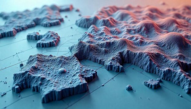
Accurate groundwater management starts with a clear picture of subsurface conditions. 3D geological modeling software allows professionals to create detailed, three-dimensional representations of geological formations, enabling better decision-making.
Traditional 2D maps often fail to capture the complexity of underground systems. In contrast, 3D models provide depth, layering, and spatial relationships that are critical for identifying aquifers, predicting water flow, and assessing resource availability. This level of detail reduces uncertainty and helps engineers and geologists design more effective groundwater extraction and conservation strategies.
How Subsurface Modeling Software Improves Environmental Project Planning
Environmental projects require careful planning to minimize risks and ensure compliance with regulations. Subsurface modeling software plays a vital role by integrating geological, hydrological, and geochemical data into a unified model.
This integration allows project teams to simulate various scenarios before implementation. Whether it’s evaluating the impact of construction or assessing soil stability, these models provide a predictive framework that improves planning accuracy. As a result, organizations can avoid costly mistakes and ensure environmentally responsible outcomes.
The Role of Hydrogeological Modeling Software in Groundwater Management
Managing groundwater resources effectively requires more than just mapping—it demands dynamic analysis. Hydrogeological modeling software enables professionals to simulate groundwater flow, recharge rates, and interactions between surface and subsurface water systems.
These tools help identify potential issues such as over-extraction, contamination spread, or declining water tables. By understanding how water moves through different geological layers, decision-makers can develop sustainable management plans that balance usage with long-term conservation.
Using Groundwater Contamination Modeling Software for Risk Assessment
Contamination poses a serious threat to both ecosystems and human health. Groundwater modeling software is essential for assessing how pollutants travel through soil and rock layers.
By simulating contamination scenarios, professionals can predict the movement and concentration of hazardous substances over time. This allows for early intervention strategies, such as containment, remediation, or monitoring. Accurate modeling not only reduces environmental damage but also helps organizations meet regulatory standards and avoid legal complications.
Benefits of Subsurface Modeling Software in Environmental Impact Assessments
Environmental impact assessments (EIAs) rely heavily on accurate data interpretation. With advanced modeling tools, professionals can evaluate how proposed projects will affect the surrounding environment.
By leveraging environmental modeling software, teams can analyze potential changes in groundwater flow, soil composition, and ecological balance. This leads to more comprehensive assessments and ensures that mitigation strategies are both effective and practical.
Additionally, these tools enhance communication with stakeholders by providing visual representations that are easy to understand, even for non-technical audiences.
Combining Mining Geology Software with Subsurface Modeling Software for Better Results
In industries such as mining, understanding subsurface conditions is critical for both safety and efficiency. Combining specialized mining tools with advanced modeling platforms creates a powerful workflow.
This integration enables better resource estimation, improved excavation planning, and enhanced risk management. By using geoscience modeling tools, professionals can analyze geological structures in greater detail and make informed decisions that optimize operations while minimizing environmental impact.
Future Trends in Hydrogeological Modeling Software and Environmental Solutions
As technology continues to evolve, modeling tools are becoming more sophisticated and accessible. Artificial intelligence, machine learning, and cloud computing are shaping the future of environmental modeling.
These advancements are enhancing subsurface data analysis software, enabling faster processing of large datasets and more accurate predictions. Real-time data integration is also becoming more common, allowing for continuous monitoring and adaptive management strategies.
In the coming years, we can expect even greater automation, improved visualization capabilities, and more collaborative platforms that bring together experts from various disciplines.
How RockWorks Software and PetraSim Geothermal Modeling Software Work Together
Modern projects often require a multidisciplinary approach, combining geological, hydrological, and geothermal data. Tools like RockWorks and PetraSim complement each other by addressing different aspects of subsurface modeling.
While one focuses on geological structures and data visualization, the other specializes in geothermal reservoir simulation. Together, they provide a comprehensive solution for projects involving groundwater, energy resources, and environmental management.
This synergy enhances efficiency, reduces data silos, and ensures that all aspects of a project are considered during planning and execution.
Why 3D Geological Modeling Software is Critical for Groundwater and Environmental Success
The complexity of today’s environmental challenges requires advanced solutions. From managing water resources to assessing environmental risks, modeling software has become a cornerstone of modern geoscience.
One of the key advantages is subsurface data visualization, which transforms complex datasets into intuitive visual models. This not only improves analysis but also facilitates better communication among stakeholders.
By leveraging these tools, organizations can achieve greater accuracy, reduce uncertainty, and make informed decisions that support both economic and environmental goals.
Simplify Subsurface Data with Smarter Solutions
Navigating complex subsurface data doesn’t have to be overwhelming. With the right tools and technology, professionals can streamline workflows, enhance accuracy, and achieve better project outcomes.
Whether you’re managing groundwater resources, assessing environmental risks, or planning large-scale projects, advanced modeling solutions provide the clarity and confidence needed to move forward. For those seeking reliable and innovative tools to simplify subsurface data and improve decision-making, RockWare Inc. offers industry-leading solutions designed to meet the evolving needs of geoscience and environmental professionals.