Search the Community
Showing results for tags 'RockWorks'.
-
A new version of RockWorks17 was uploaded to the RockWare website today, with the following new features, improvements, and bug fixes: New Version: + 32-bit version now available! New Features: + A new Clip to Project Boundaries option has been added to the DXF, Shape, and DLG import options within RockPlot3D. + An option has been added to the RockPlot3D DXF import to clip the DXF file to the project boundaries. + The RockPlot3D Digitize program now displays the digitized points and lines. + The RockPlot3D data list now includes button options for expanding and collapsing the scene tree. + The RockPlot3D program now includes an option for outlining voxels. Improvements: + The Sieve Analysis program now provides error-messaging to indicate missing sieve size information within the header. + The RockPlot3D Shape Export now includes the Z-value (elevation) for triangles. + The RockPlot3D DXF Export now includes the Z-value (elevation) for triangles. + RockPlot3D now exports text to DXF. + The RwDat Templates have been updated to use the Status column. + An Undo option has been added to the Image Rectification program. Bug Fixes: + Changes to the PLSS Range and Township editing options are now properly retained. + A number of changes have been made to the tree-style menus to fix editing and filter problems. + The RockPlot3D Cutout now includes the full X and Y ranges for voxel models + Slices within RockPlot3D Voxel models are now fully redrawn after adjusting their positions with the slider bar. + Using the Infer Partial Units option for a borehole with no defined tops or bases no longer produces an Access Violation error. Removal: + The Menu Font Size option has been removed from the Preferences | General | Fonts menu and all menus have been "hard-wired" to a 12-point font. This change has been made due to the sluggishness associated with supporting variable menu font dimensions. For a complete list of the recent changes, please visit: https://www.rockware.com/rockworks/revisions/current_revisions.htm To download this build, use the Help | Check for Updates menu inside RockWorks17. Or visit the demo download page: https://www.rockware.com/product/productDemo.php?id=165 Note that you will not be able to use this new build of the program if your maintenance has expired. Contact RockWare Sales or visit the new Customer Portal (https://www.rockware.com/customer/index.php) if you would like to update your maintenance. Molly Mayfield RockWare Inc
-
A new version of RockWorks17 was uploaded to the RockWare website today, with the following improvements and bug fixes: IMPROVEMENTS + Stratigraphic Units that extended below the boreholes' Total Depth are now included within the stratigraphic modeling. This provides greater utility for users when the Lithology and Stratigraphy Picker programs are used to interpret units below the logs. + All data that extends beyond the Total Depth is now displayed within the strip logs. + The ModPATH Import program now imports data that uses more than one space to delimit the data fields. + The Utilities - Datasheet | Additional File Information default coordinate system zone is now set to the project's values. + A reminder about rescaning the subsites has been added to the confirmation when reprojecting/reassigning project coordinates and rescaning the boreholes. + When prompting to save the RockPlot 2D on exit, the initial directory is now set to the current project folder. + The confirmation dialogs for setting project coordinate systems have been adjusted. BUG FIXES + The Grid Math | Grid and Constant program now uses the correct file input and output settings. + When reprojecting/reassigning project coordinates and then rescaning the boreholes an access violation was being raised if the Quickmap window was showing. The program will now change back to the Borehole Data page before reprojecting/reassigning. For a complete list of the recent changes, please visit: https://www.rockware.com/rockworks/revisions/current_revisions.htm To download this build, use the Help | Check for Updates menu inside RockWorks17. Or visit the demo download page: https://www.rockware.com/product/productDemo.php?id=165 Note that you will not be able to use this new build of the program if your maintenance has expired. Contact RockWare Sales or visit the new Customer Portal (https://www.rockware.com/customer/index.php) if you would like to update your maintenance. Molly Mayfield RockWare Inc
-
A new version of RockWorks17 was uploaded to the RockWare website today, with the following improvements and (important) bug fixes: IMPROVEMENTS + The following improvements have been made to the AGS Import program: + The Decimal Point Delimiter may now be specified. For example, a comma rather than a period can be used as a decimal delimiter. + I-Data, T-Data, and P-Data imports now include the units. + Switching from the Source tab sheet directly to the Location tab sheet will no longer produce an error pertaining to missing units. + Dates now import more consistently based on the Units line. + Selected AGS tables are now pre-mapped. + The arrow icon within the Previous and Next buttons no longer disappear or incorrectly change directions. + The Picture Hints within the Project Manager are now offset from the mouse position thereby no longer obscuring the file names. + All Utilities programs that process file names within the Datasheet now offer options to Continue, Abort, or Ignore. + The Drape program can now use an image file that is not stored within the current Project Folder. + The ModPath Import program can now handle multiple space-delimited files. BUG FIXES + The Block Diagram dialog no longer generates an Access Violation when used within an application 3D Faults are not available or if the licensing level does not permit 3D Faults. + The Isomesh dialog now correctly saves the menu settings. + The Reassign and Reproject options within the Settings | Coordinates page now correctly displays the Output units. + Importing a single file into the Borehole Manager now works correctly. + The Image Rectify dialog now recognizes Cut, Copy, Paste, and Delete hotkeys. + Selecting the 3D Output option from within the Image Rectify dialog now changes tab pages correctly and longer leaves the status dialog on top. + The RockPlot3D | Morph | Continuous option now works correctly without generating error messages. For a complete list of the recent changes, please visit: https://www.rockware.com/rockworks/revisions/current_revisions.htm To download this build, use the Help | Check for Updates menu inside RockWorks17. Or visit the demo download page: https://www.rockware.com/product/productDemo.php?id=165 Note that you will not be able to use this new build of the program if your maintenance has expired. Contact RockWare Sales or visit the new Customer Portal (https://www.rockware.com/customer/index.php) if you would like to update your maintenance. Cheers! Molly Mayfield RockWare Inc
-
A new version of RockWorks17 was uploaded to the RockWare website today, with the following new features, improvements, and bug fixes: New Features + A new option for editing the list of Pick Lists has been added to the datasheet column menu. + It is now possible to define the output dimensions for animations from the PicShow, RockPlot3D, Grid-Morphing, and Solid Modeling programs. Improvements + The P-Data Fill Style, Border, and Direction options within the 2D striplog designer have been moved from the tree menu to a separate dialog that is accessed from the Options button adjacent to the Fill Options heading. + The I-Data Fill Style, Border, and Direction options within the 2D striplog designer have been moved from the tree menu to a separate dialog that is accessed from the Options button adjacent to the Fill Options heading. + The size and position of the stand-alone RockPlot3D viewer is now saved. + The name of the currently displayed file is now shown within the stand-alone RockPlot3D viewer. + The Shape -> RockPlot2D importer now prompts the user to save when closing the window. + The Legend button for programs that create block diagrams have been removed. Instead, they are now contained within the Block Diagram Options menu. + The Color-Scheme button that linked to a separate dialog within menus that create 3D block diagrams has been removed. Instead, the Color Scheme options are now accessed from within the Block Diagram | Diagram Type menu Bug fixes + Checking the Shaded-Relief option within the color-contouring menu no longer disables the other color options. + The Shaded-Relief color-filled contouring no longer hangs up if a perfectly flat triangle is encountered. + The Utilities | Grid | Math | Absolute program no longer generates an error saying that it is unable to find the "XY_COLUMN" menu. + The wireframe display of voxel models is no longer vertically offset. + The PicShow animation options are now displayed, the original images are no longer overwritten when creating animations, and the original aspect ratios are used when creating the animations. + The Utilities | Imagery | Rectify program no longer generates an error if the user elects to plot a 2D diagram of the output. + The Utilities | Imagery | Drape program no longer displays the image-rectification options. For a complete list of the recent changes, please visit: https://www.rockware.com/rockworks/revisions/current_revisions.htm To download this build, use the Help | Check for Updates menu inside RockWorks17. Or visit the demo download page: https://www.rockware.com/product/productDemo.php?id=165 Note that you will not be able to use this new build of the program if your maintenance has expired. Contact RockWare Sales or visit the new Customer Portal (https://www.rockware.com/customer/index.php) if you would like to update your maintenance. Enjoy! Molly Mayfield RockWare Inc
-
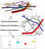
A new version of RockWorks17 was uploaded to the RockWare website today, with the following new features and improvements: New Features: Display infrastructure (buildings, roads, pipes, etc.) in a 2D map format Display infrastructure in a 3D scene. Display infrastructure in profiles and cross sections. Enable all of the boreholes within a subsite whenever the subsite is changed. Disable all of the boreholes outside of a subsite whenever the subsite is changed. Save the LogPlot Import settings to an XML file for subsequent imports. Reposition / maximize / stretch program dialogs across multiple monitors, with a single click. and much more! Improvements: The AGS Data Viewer now works in a non-modal fashion thereby allowing the user to view the data that is being imported. The LogPlot Import program now supports both LP7 and LP8 formats. The LogPlot Export program now supports both LP7 and LP8 formats. Close the 2D Solid Model Editor without saving the changes. Solid | Math | Model & Model tree menu was reworked into a less cluttered dialog box. Grid | Math | Grid & Grid tree menu was reworked into a less cluttered dialog box. much more For a complete list of the recent changes, please visit: https://www.rockware.com/rockworks/revisions/current_revisions.htm To download this build, use the Help | Check for Updates menu inside RockWorks17. Or visit the demo download page: https://www.rockware.com/product/productDemo.php?id=165 Note that you will not be able to use this new build of the program if your maintenance has expired. Contact RockWare Sales or visit the new Customer Portal (https://www.rockware.com/customer/index.php) if you would like to update your maintenance. Enjoy! Molly Mayfield RockWare Inc
-
A new version of RockWorks17 was uploaded to the RockWare website today, with the following fixes: + Fixed a problem in which bargraph data ranges were omitted from the title area of 2D striplogs if table-based scaling was used + Reorganized the tree menu for Solid Model Display options. + See also yesterday's posting with many new features: https://www.rockware.com/forum/index.php?showtopic=2725 To download this build, use the Help | Check for Updates menu inside RockWorks17. Or visit the demo download page: https://www.rockware.com/product/productDemo.php?id=165 Note that you will not be able to use this new build of the program if your maintenance has expired. Contact RockWare Sales or visit the new Customer Portal (https://www.rockware.com/customer/index.php) if you would like to update your maintenance. Molly Mayfield RockWare Inc
-
A new version of RockWorks17 was uploaded to the RockWare website today, with the following new features, improvements, and fixes: + New feature: A Project Image tab has been added to the project group of tabs at the top of the program window. The Project Image is a satellite image, airphoto, scanned map, or any other type of raster image that can be used as a map background image for profile stripmaps and future applications + New feature: Include Project Images in profile stripmaps + New RCL command NEWPROJECT: which brings up the "Create New Project Wizard" and populates the "New Project Folder" field with data from the RCL script. + New feature: Add peripheral images, such as logos or north arrows, to your map borders. Some example images are now installed with the program. + New feature: Add a scalebar to your map borders + New feature: A Coordinate System Summary is now displayed in a green box to the right of the Datasheet menu barr. If there is a mis-match between the coordinates defined for the datasheet columns and the project, the box will turn red. + New feature: "smarts" have been added to the Utilities EZ Mapper and Grid-Based Mapper so that spatial data columns with undefined coordinates and units can be assumed to comply with the project coordinates and automatically updated as such + Improvement: Program can warn user if section endpoints are outside the defined project area + Fixed problem in which a Production table error prevented opening and updating all of the tables from a RockWorks16 projects into RockWorks17 + Fixed problem with solid model Krajewskigram symbols. + Fixed problem with Extract Solid 3D surfaces. + Fixed problem in which the grid model over which a surface is draped was deleted from the project folder. + Fixed problem with the Contour Animator and unrecognized image paths + Fixed problem closing undocked RockPlot3D windows + much MUCH more To download this build, use the Help | Check for Updates menu inside RockWorks17. Or visit the demo download page: https://www.rockware.com/product/productDemo.php?id=165 Note that you will not be able to use this new build of the program if your maintenance has expired. Contact RockWare Sales or visit the new Customer Portal (https://www.rockware.com/customer/index.php) if you would like to update your maintenance. Molly Mayfield RockWare Inc
-
A new version of RockWorks17 was uploaded to the RockWare website today, with the following improvements and bug fixes: + Fixed a problem with undocked RockPlot3D windows causing an error on close + Fixed a problem with Excel import into P-Data tables To download this build, use the Help | Check for Updates menu inside RockWorks17. Or visit the demo download page: https://www.rockware.com/product/productDemo.php?id=165 Note that you will not be able to use this new build of the program if your maintenance has expired. Contact RockWare Sales if you would like to update your maintenance. Molly Mayfield RockWare Inc
-
A new version of RockWorks17 was uploaded to the RockWare website today, with the following improvements and bug fixes: + A "Watch Video" button has been added to many menus in RockWorks17 for immediate connection to YouTube for "Video Help" - striplogs, profiles, sections, 3D logs, gamma to grade, RCL scripts, grid dimensions, continuity filter, lithology piecharts, and many more. + A new "Multivariate Map" program has been added to the Lithology menu - create maps with pie charts or starburst diagrams which depict the relative amounts of various lithologies in that vicinity. An excellent quick-reference. + The GeoBody Filter program has been completely redesigned. This new "Continuity Filter" makes it easier to specify a range of values to be evaluated for continuity. It also runs faster. + New features and improvements to the Grids -> Stratigraphic Model program in the Utilites: Conventional diagrams, Exploded diagrams, and Quadrant diagrams which split the diagram into quadrants to peek inside. + The title for 3D strip logs can now be customized to include additional fields. + When creating an SQLite project based on an SQL Server project, the Data Dictionary is now created and the data is correctly copied from the original project. + Fixed a problem with "EZ" P-Data and I-Data correlations in Striplog Sections. + Fixed a problem exporting LogPlot DAT files. + Fixed a problem running a Database Statistics report. + Fixed a problem exporting non-US numbers to Excel and text from the Utilities. + Vertical grid lines in 2D strip logs are now correctly clipped. + much more To download this build, use the Help | Check for Updates menu inside RockWorks17. Or visit the demo download page: https://www.rockware.com/product/productDemo.php?id=165 Note that you will not be able to use this new build of the program if your maintenance has expired. Contact RockWare Sales if you would like to update your maintenance. Molly Mayfield RockWare Inc
-
A new version of RockWorks17 was uploaded to the RockWare website today, with the following improvements and bug fixes: + New feature for the Grids -> Solid Model program: assign nodes between surfaces the value stored in an existing grid model. Great for applying concentration data from a grid model to a solid model. + New feature for the Imagery | Rectify program: Use the NW, NE, and SE project corners as the calibration points. This eliminates the cumbersome step of typing or copy/pasting these coordinates into the menu. + New features for the Borehole Manager Types tables (Lithotypes, Stratatypes, Aquifertypes, etc.): Automatically delete unused and turned off rows. This is very useful for cleaning up these tables after importing from another project, from LogPlot, etc. + Another fix to a problem renaming layers in RockPlot2D + When creating a SQLite project based on a SQL Server project, the Data Dictionary is now created and the data copied from the original project correctly. + much more To download this build, use the Help | Check for Updates menu inside RockWorks17. Or visit the demo download page: https://www.rockware.com/product/productDemo.php?id=165 Note that you will not be able to use this new build of the program if your maintenance has expired. Contact RockWare Sales if you would like to update your maintenance. Molly Mayfield RockWare Inc
-
A new version of RockWorks17 was uploaded to the RockWare website today, with the following improvements and bug fixes: + Improvement to the IHS 298 import, to set the "Days Produced" to the number of days in the month as default when the production data has a zero in the "Days on Production" field. + A new version of the DLL that does the compression (ZIP) for RockWorks has been included in the installation (fixes a bug, buffer overrun) + Fixes to the P-Data contouring programs (profile, plan, etc.) - correct data ranges are reported + Fix to a problem registering RockWorks17 as a COM object + Fix to a problem renaming layers in RockPlot2D + Improvements to the RockPlot3D zoom tool + much more To download this build, use the Help | Check for Updates menu inside RockWorks17. Or visit the demo download page: https://www.rockware.com/product/productDemo.php?id=165 Note that you will not be able to use this new build of the program if your maintenance has expired. Contact RockWare Sales if you would like to update your maintenance. Molly Mayfield RockWare Inc
-
A new version of RockWorks17 was uploaded to the RockWare website today, with the following improvements and bug fixes: + Redesigned Animation menu in RockPlot3D with all-new tools for isolevel, "reveal", rotation, and morph animations + Improved import for multiple LAS files into the RockWorks database + A faster and more reliable algorithm for plotting fault intersections within sections and profiles + New column layout dialogs in the 2D and 3D Striplog designers + Fixed a problem with Superface and Subface filters with Warped or Tilted block models + Improved display of points in Profile, Section, Projected Section, and Fence selection maps + much more To download this build, use the Help | Check for Updates menu inside RockWorks17. Or visit the demo download page: https://www.rockware.com/product/productDemo.php?id=165 Here is a detailed list of the revisions: https://www.rockware.com/rockworks/revisions/current_revisions.htm Note that you will not be able to use this new build of the program if your maintenance has expired. Contact RockWare Sales if you would like to update your maintenance. Molly Mayfield RockWare Inc
-
A new version of RockWorks17 was uploaded to the RockWare website yesterday, with the following improvements and bug fixes: + Improvement: The maximum number of nodes (population) that can be processed by the Utilities | Solid | Statistics program has been increased from 2,147,483,647 to 2^63. + Improvement: Saving Bitmap table entries were causing excessive warnings if the user did not enter a bitmap type before trying to depth register the bitmap. + Bug Fix: The Project Notes are now properly saved. + Bug Fix: The labeling within the Projected Section location maps has been fixed. + Bug Fix: Creating a Projected Section with more than 50 points no longer causes an Access Violation. + Bug Fix: RockWorks is now properly launched when related files are double-clicked within the Windows File Explorer program. To download this build, use the Help | Check for Updates menu inside RockWorks17. Or visit the demo download page: https://www.rockware.com/product/productDemo.php?id=165 Here is the full revision list: https://www.rockware.com/rockworks/revisions/current_revisions.htm Note that you will not be able to use this new build of the program if your maintenance has expired. Contact RockWare Sales if you would like to update your maintenance. Molly Mayfield RockWare Inc
-
A new version of RockWorks17 was uploaded to the RockWare website today, with the following bug fixes: + The Striplogs | 2D | Section options window now displays all of the menu settings. + In ReportWorks, using the arrow keys to move selected items no longer changes the selected layer. + Fixed a memory leak that occurred every time a solid model file (RwMod) was loaded. + Inserting a new Stratigraphic unit in the Stratigraphy Picker no longer populates the new unit with the values of the unit below. + The Preferences | General Program Settings | Updates now correctly turns on/off the check-for-updates setting. To download this build, use the Help | Check for Updates menu inside RockWorks17. Or visit the demo download page: https://www.rockware.com/product/productDemo.php?id=165 Note that you will not be able to use this new build of the program if your maintenance has expired. Contact RockWare Sales to update your maintenance. Enjoy! Molly Mayfield RockWare Inc
-
A new version of RockWorks17 was uploaded to the RockWare website today, with the following new features, improvements, and bug fixes: New Features: + Stratigraphy Modeling - Underlap builds models from upperlayers downward (the opposite of Onlap) + Overlays - Include up to 5 RockPlot2D diagrams as layers in your new maps (Grid-based maps, EZ maps, borehole location maps, borehole manager structure maps, plan maps + Create List of Logs - Programs that include 2D striplogs (e.g. profiles, sections) can output a list of the boreholes included in the diagram. + Stiff Diagram Maps - Scale the Stiff polygons based on TDS + Stiff Diagrams - Add a symbol key to Stiff diagrams + Correlate Grids - New program for automatically comparing grid models representing different measurements ("apples v oranges") to show anomalies + Utilities Datasheets - Flexible and powerful Find-and-Replace program + Utilities Datasheets - Left/center/right-justify columns, and add a margin for readability + Utilities Solid | Convert | Solid -> Grid, redesigned window and new converters: Median, most frequently occurring G-value, number of non-null voxels, Number of null voxels, standard deviation + EarthApps - New Descent From Space option for advanced circular flyovers Improvements: + Stratigraphy Modeling - Improved logic for replacing uppermost unit with an external grid when the top unit has been disabled + Quickmap - missing background image or worldfile automatically disables that layer + GeoBody Filter - small geobody threshold based on percent volume, report includes percent volume calculation, no longer displays small disconnected geobodies. + Piper Diagram - redesigned options window + 2D Color Legends - use negative X and/or Y offsets to plot the legend within the map + Stratigraphy modeling - redesigned menu + Stripmaps - redesigned menu + Histograms - redesigned menus + Stiff diagrams - redesigned menus + Help menu - redesigned for easier access, including video links Bug Fixes: + Raster image calibration window + Edit as Datasheet pointer error + RockPlot3D Zip all Linked Files warning if the file path is longer than Windows allows To download this build, use the Help | Check for Updates menu inside RockWorks17. Or visit the demo download page: https://www.rockware.com/product/productDemo.php?id=165 Note that you will not be able to use this new build of the program if your maintenance has expired. Contact RockWare Sales to update your maintenance. Bon apetit! Molly Mayfield RockWare Inc
-
A new version of RockWorks17 was uploaded to the RockWare website today, with the following bug fix: + Opening existing projects and creating new projects no longer trigger an Access Violation error. To download this build, use the Help | Check for Updates menu inside RockWorks17. Or visit the demo download page: https://www.rockware.com/product/productDemo.php?id=165 Molly Mayfield RockWare Inc
-
A new version of RockWorks17 was uploaded to the RockWare website today, with the following new features, improvements, and bug fixes: + New Features: A new program titled "Contour Animation" has been added to the Utilities | Map menu.This program creates contour map animations based on data that changes over time (e.g. groundwater potentiometric surface elevations). These animations may be saved as animated GIF, AVI, Google Earth Timespans, individual images, or PicShow slide shows. + New Feature: The Data Dictionary has been moved inside of the database for SQL Server projects. This new feature allows the RockWorks database to be located within the Microsoft Azure cloud! (Advanced level only) + New Features: Options have been added to the following programs that allow the changes to be made to the current borehole, all enabled boreholes, and all boreholes: P-Data | Analyze | Resample, Logarithmic, Gamma-to-Grade, GT (Grade x Thickness) Compositing, Add Random, Resample; I-Data | Analyze | GT (Grade x Thickness) Compositing; Colors | Analyze | Comments to Color, Raster Imagery to Color + Improvements to the AGS (Version 3.1) Importer for files which are not fully compliant to the standard. + Improvements to the Section, Profile, Projected Section, and Fence Selection Maps - less flicker when Snap is requested. + Improvements to the interface for selecting the ion columns for Durov, Ion Balance, Piper Diagram, Stiff Diagram, Stiff Map, and Total Dissolved Solids programs + Huge improvements to the Pie Chart Map, Bar Chart Map, Spider Map, Starburst Map programs - easier setup of data columns, increased number of components, auto-offset for readability, improved labeling, redesigned Symbol Key, more diagram options, more flexible scaling options + Improvements to Stiff Map program - auto-offset + Improvement to the Utilities | Import | External Database (previously "ADO"), the program uses a FireDAC (quasi-universal database interface) connection dialog to connect to a database. FireDAC uses ODBC and not ADO/OLEDB drivers. + Improvement: The initial browse for a project folder allows the creation of a new folder. This occurs when launching RW17 without an installed Samples folder if the Preferences | General Program Settings | On Startup | Prompt For Folder option has been enabled. + Bug Fix: The Striplogs | Fill-In Missing Stratigraphy utility no longer sporadically rounds the depths to integers. + Bug Fix: The I-Data Length Composite Weighting (LCS) no longer sporadically rounds the depths to integers. + Bug Fix: Picking a polygon fill from the Lithology or Stratigraphy types within RockPlot2D no longer requires an Advanced License. + Bug Fix: Enabling the Volumetrics within Stratigraphic Modeling no longer causes an Access Violation during the model processing. + Bug Fix: Cutouts are now properly pasted to surfaces within RockPlot3D. + Bug Fix: The Clear button in the Profile Selection dialog now clears the previous profile from the display. + Bug Fix: Database errors that occur when changing between projects that use different database engines no longer occur. + Bug Fix: The Help Browser within the main Preferences dialog is no longer disabled if the Help-From-Folder option is disabled. To download this build, use the Help | Check for Updates menu inside RockWorks17. Or visit the demo download page: https://www.rockware.com/product/productDemo.php?id=165 To see the very detailed revision list, please visit: https://www.rockware.com/rockworks/revisions/current_revisions.htm Molly Mayfield RockWare Inc
-
A new version of RockWorks17 has been posted to our website with the following changes: + The Optional Fields tab is now visible for all feature levels. + LAS imports for multiple files now test for and adds a trailing path delimiter if it's missing. + Spatial Filter options have been added to the Utilities / Volumetrics / Block Model Grade Statistics By Level program. + The 3D Shape Export no longer fails to include a trailing slash character if the output path is changed. + The check for lack of data (barren) in BorePlot, now only gets counts from the db instead of full DataSets meaning that the program now runs faster on network-based configurations. + The PLSS conversion within the Utilities / EarthApps / Points / Quick-Locator program now works correctly. + The Range & Township (Public Land Survey) conversion within the Utilities / Coordinate Converter / Single-Point program now works correctly when using the Footage-From-Line option. + Pasting data from the Windows clipboard into a single cell within the Lithology Picker now works correctly when a clipboard item contains an invalid number. The Tab key now works between data cells, and negative values no longer change the zoom state. + Pasting data from the Windows clipboard into a single cell within the Stratigraphy Picker now works correctly when a clipboard item contains an invalid number. The Tab key now works between data cells, and negative values no longer change the zoom state. + For MS SQL Server the "DBCC CHECKIDENT" command is used to reset the table's starting primary key back to 1. If the user does not have sufficient rights to do this the program will trap it and continue on. To download this build, please visit: https://www.rockware.com/product/productDemo.php?id=165 To see the detailed revision list, please visit: https://www.rockware.com/rockworks/revisions/current_revisions.htm Bon appetit! Molly Mayfield RockWare Inc.
-
We have just posted a new build of RockWorks17 with a number of new features: + Disable Data Based On Distance From Closest Borehole + New "data fill" program for the Utilities datasheet + Borehole Has Zero Depth warning + Design changes to the Pick Lithologic Intervals program + Design changes to the Pick Stratigraphic Contacts program + New programs for exporting data from Project Tables to the Utilties datasheet + Copy faults from one grid to another + New features and improvements to the grid smoothing algorithm + New SQLite menu options for checking, analyzing, and cleaning up the database + RockWare GIS Link 17 has been added to the RockWorks17 installation program + Install RockWorks17 webhelp locally for when you don't have internet access + Improved large font support for program windows and menus + New features added to the Geobody filter program + 3D faults embedded within grid and solid models (Advanced) + New RCL "Sound" command for handy alerts (e.g. when a script is done) (Advanced) + New Production table in the database and menu in the Borehole Manager for display of production charts, "billboards" in Google Earth, graph maps, bubble maps, and 3D "spindles" (Advanced) + Improved display of 3D faults with surfaces, stratigraphic models, and solid models (Advanced) + Edit/add SQL Statements in the Filter Boreholes and Select Boreholes query windows (Advanced) + a whole bunch of bug fixes (state plane coordinates, borehole display in section/profile/fence picking windows, To download the most recent build, please visit: https://www.rockware.com/product/productDemo.php?id=165 To read the detailed revision list, please visit: https://www.rockware.com/rockworks/revisions/current_revisions.htm Enjoy! RockWare Support
-
If you have the RockWorks 16 build 2015.12.9 or RockWorks 17 build 2015.10.15 installed, you may see this error displayed when you check for updates when you launch RockWorks: Ancestor for pnlDirectory not found This simply means that the program has detected a new version on our website (which we posted today) and there may be a problem with the window which displays the new-update message. This problem pertains to the check-for-updates window only and does not affect the rest of the program. You can manually download and install the RockWorks update by following these steps: 1. Click on the following link: RockWorks 17, 16 - Current and Archived Versions: https://www.rockware.com/support/rockworks-support/rockworks-downloads/rockworks-product-updates/ 2. Save the installation program to your computer. 3. When the download is complete, run the installation. Do not uninstall the existing program first. 4. When the installation is complete, launch RockWorks. Note that because the bug is with the auto-updater, you'll need to manually download this build. The auto-updater should work for future updates. Let us know if you have any questions about this. Molly Mayfield RockWare Inc (TB- edit to add Rw16 )
-
We uploaded a new revision of RockWorks16 today, with the following changes: + Double-clicking on an RwDat file no longer raises an exception when the "Load Last-Used File in Datasheet on Start-Up" option is activated. + Scattergrams now use the diagram size to set symbol and label sizes for consistent results. + Raster images are now stored in RockPlot2D as PNG images. This enables faster load times and smaller files. Saving files, however now takes a bit longer. + The Utilities | File | Print program no longer incorrectly offsets the columns by 1. You can download this new revision of RockWorks16 either from within RockWorks itself (Help | Online Information | Check for Updates) or by following these steps: 1. Click on this link: http://www.rockware.com/assets/products/165/product_demo/229/rockworks16_installation.exe 2. Save the file to your local computer (e.g. Downloads folder or Desktop). 3. When the download has completed, run the installation. Do not uninstall the existing RockWorks first. 4. When the installation has completed, start the RockWorks16 program. Bon apetit! Molly Mayfield RockWare Inc.
-
We uploaded a new revision of RockWorks16 today, with the following changes: + RockWorks is now re-enabled if the backup fails. + The Datasheet / Import / Shape File program now displays status messages as the Shape file is being imported. + The AGL Editor (accessed from the RockPlot2D / File / Import / AGL program via the Edit/Create option) no longer generates an error when selected. + RockWorks will now gracefully shut down if a connection to an SQL server is lost. This eliminates the need to used the Task Manager to shut it down. + The RockPlot3D Isosurface Options menu now includes a button titled "Add + Hide Model". This new option will change the Draw Style for the model to Hidden thereby insuring that the new slice will be visible. + The RockPlot3D Solid Model Options menu now includes a button titled "Add + Set Style to Point". This new option insures that the new slice will be visible. + The StripLog / Projected Section menu now includes options for activating/de-activating the clipping. + The symbol that is used for showing the top of a borehole now plots correctly if the clipping is enabled when plotting 2D striplogs. + The calculated volume and mass for stratigraphy volumetrics that are based on grid models is now converted to the selected output units. Check out the Revision List: https://www.rockware.com/rockworks/revisions/current_revisions.htm You can download this build either from within RockWorks itself (Help | Online Information | Check for Updates) or by following these steps: 1. Click on this link: http://www.rockware.com/assets/products/165/product_demo/229/rockworks16_installation.exe 2. Save the file to your local computer (e.g. Downloads folder or Desktop). 3. When the download has completed, you can run the installation. Do not uninstall the existing RockWorks first. 4. When the installation has completed, you can start up the RockWorks16 program. Enjoy! Molly Mayfield RockWare Inc.
-
We uploaded a new revision of RockWorks16 today, with the following changes: + Fixed a bug introduced in yesterday's published build which rendered unrecognizable the PLSS Landgrid tables (stored in C:\ProgramData\RockWorks\Landgrid). (Note that these U.S. landgrid files are installed separately from the RockWorks program. If you have already downloaded these landgrid files, you don't need to do so again. You'll just need to reinstall a newer build of the RockWorks16 program itself.) You can download this new revision of RockWorks16 either from within RockWorks itself (Help | Online Information | Check for Updates) or by following these steps: 1. Click on this link: https://www.rockware.com/assets/products/165/product_demo/229/rockworks16_installation.exe 2. Save the file to your local computer (e.g. Downloads folder or Desktop). 3. When the download has completed, run the installation. Do not uninstall the existing RockWorks first. 4. When the installation has completed, start the RockWorks16 program. Apologies for any inconvenience! Molly Mayfield RockWare Inc.
-
We uploaded a new revision of RockWorks16 today, with the following changes: + Expanded memory for larger models: Windows 64-bit from 2 to 4 gigabytes + New "horizontally biased kriging" algorithm for 3D block modeling + New filter for filling voids in 3D block models + Slice coordinates in RockPlot3D "model reveal" animations (see video below) + Scriptable profile and section axes titles + Improved AGS data import, especially with non-standard files + Improved statistics reports (data and grids) + and much more! Check out the Revision List: https://www.rockware.com/rockworks/revisions/current_revisions.htm You can download this build either from within RockWorks itself (Help | Online Information | Check for Updates) or by following these steps: 1. Click on this link: https://www.rockware.com/assets/products/165/product_demo/229/rockworks16_installation.exe 2. Save the file to your local computer (e.g. Downloads folder or Desktop). 3. When the download has completed, you can run the installation. Do not uninstall the existing RockWorks first. 4. When the installation has completed, you can start up the RockWorks16 program. Enjoy! Molly Mayfield RockWare Inc.
-
We don't typically post new builds on Fridays as we head into the weekend, but the 2015.1.29 build uploaded yesterday created DLL errors for a few users, so we feel compelled to post this fix. This revision fixes errors related to "MSVCP100.dll" and "FreeImage32.dll" which were preventing RockWorks16 from launching. To download this version, follow these steps: 1. Click this link: https://www.rockware.com/assets/products/165/product_demo/229/rockworks16_installation.exe 2. Save the file to your computer. 3. When the download is complete, run the installation. You do not need to uninstall the existing copy first. 4. When the installation is complete, run the program. Contact tech at rockware.com if you experience any problems with this revision. thanks, Molly Mayfield RockWare Inc.