New Versions
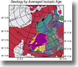
Surfer 13
New version of this popular contouring software
 Surfer 13 has been released with many new features: Surfer 13 has been released with many new features:
+Add Map Graticules (Grid Lines) in Lat/Long
+
Calculate and display viewsheds
+
Query base layer attributes
+
Create buffers around lines and points
+
Display Lat/Long labels in degrees/minutes/seconds
+ much more
Read more
Download demo
Surfer pricing
RockWorks 16
Update available
A new build of RockWorks 16, our comprehensive program for visualization and modeling of spatial and subsurface data, has just been posted to rockware.com.
 What's new in RockWorks 16: What's new in RockWorks 16:
+ New "slice" options in RockPlot3D
+ Improved elevation clipping in projected cross sections
+ Improved volume calculations for stratigraphy models
+ Improved scaling for XY Scatter Plots
+ Compressed storage of raster images in RockPlot2D
+ and more
Check out the Revision List.
Current users can download the new build via the program's Help | Online Information | Check for Updates menu.
Read more
Download demo
RockWorks pricing
Training
TOUGH Symposium
The symposium on applications and enhancements to the TOUGH codes for multiphase fluid, heat, and chemical transport will be held at the Lawrence Berkeley National Laboratory (LBNL), September 27 - 30, 2015. The TOUGH Symposium 2015 consists of oral and poster presentations, with proceedings published online, and includes a welcome reception, poster session, and banquet dinner featuring an invited talk. Short Courses on select TOUGH codes will be offered immediately preceding and following the Symposium.
The early-bird pre-registration deadline is August 28; after August 28, registration fees will increase. Please register online.
Registration for all Short Courses is now available.
Visit the Symposium web page for more details.
Web Resources
New RockWare Videos
3D Oilfield Production Diagrams
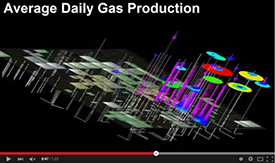
"Spindle" Diagrams for Depicting Historical Production
Articles, Websites
Water Used for Hydraulic Fracturing Varies Widely Across United States
(USGS)
Frac Sand Sources in the US
(GeoCommunity)
Mt Mckinley to be GPS surveyed
(USGS via GeoCommunity)
Growing mystery—getting to the bottom of the highest peak in the Lower 48
(Ars Technica)
Tectonic Model Shows North America May Once Have Been Linked to Australia or Antarctica
(GeoCommunity)
USGS Science in your Backyard
(USGS)
Flood map
(arcgis.com)
7 Powerful Photos Before and After the California Drought
(buzzfeed)
New Horizons Pluto Mission
(NASA)
Explaining the Scale of the Solar System using the Thousand Yard Model
(EPOD)
Interactive GIS Map of Venus
(USGS)
TSA Lost and Found
(ESRI)
Tips
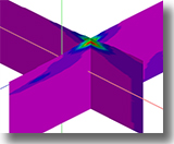
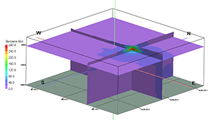
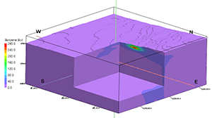
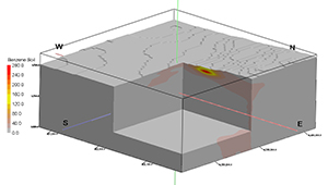
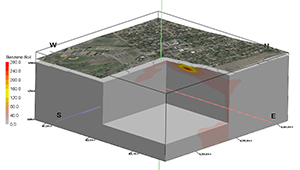
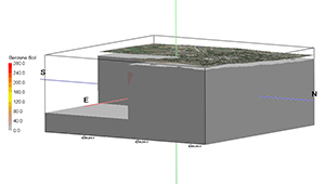
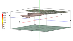
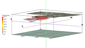
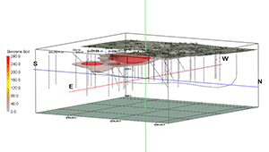
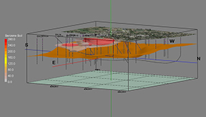
3D Block Model Visualization Tools in RockWorks 16
Here are just a few of the many options for viewing a block (plume) model in RockWorks16:
Insert horizontal and/or vertical slices:
Display as an isosurface with a cutout:
Change the color scheme:
Add an aerial photo with a cutout:
Change the viewing angle and direction:
Display the isosurface at a specific concentration value:
Display another contour level inside the isosurface:
Add the 3D logs:
Add a constraining stratigraphic surface, change the background color, and create an animation video:
And much more!
Read more about RockWorks 16
RockWorks pricing
Download demo
|