The TriLayering algorithm is designed to provide a tool for
modeling lithology datasets that represent layered but laterally discontinuous
materials that do not laterally grade from one material type to another. The interpolation method creates a Delaunay
triangle network for each layer and then projects the lithologies from the
control points within that layer towards points that share the same
triangle.
Extrapolation: The triangles
projection can be subdivided at their limb midpoints (Figure
1 - left) or a random location
somewhere in-between to the vertices (Figure
1 - right).
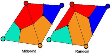
Figure 1
A comparison of midpoint versus random extrapolation (Figure
2) illustrates how the random
extrapolation can produce more geologically reasonable models that suggest
transgressive/regressive sequences.
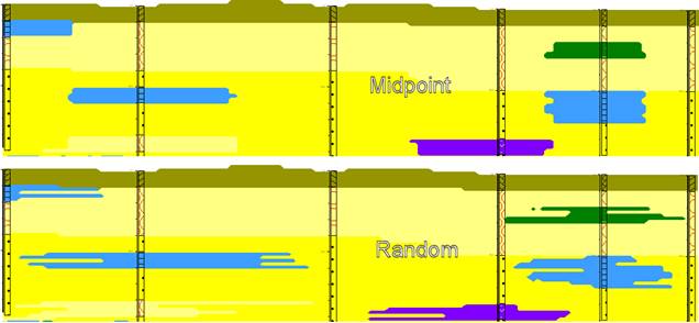
Figure 2
Please note that the random extrapolation method will never
generate the same model twice (Figure
3).
Although the region immediately surrounding the boreholes will “honor”
the borehole data, the interpolations between boreholes will randomly vary
between the laterally surrounding lithologies.
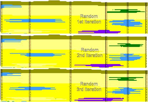
Figure 3
Minimum Extrusion Distance:
If the Random
option is selected, the Minimum Extrusion Distance defines how far the control
point lithotypes should be projected before the randomization occurs (Figure 4).
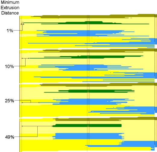
Figure 4
Fill Region Outside Triangulation Network: If unchecked, the triangulation will only extrapolate voxels
within a convex polygon that encompasses the control points for a given layer (Figure
5 - Top). If checked, this option will add imaginary
control points within the model corners based on the g-values for the closest
control points (Figure
5- Bottom).
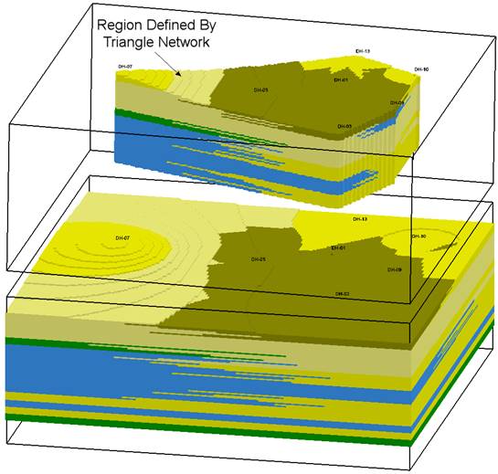
Figure 5