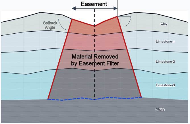
The RockWorks Easement Filter is used to either eliminate or retain portions of a solid (block) model encumbered by an easement. Input consists of a block model, a polyline representing the easement centerline, the easement width, the setback slope angle, and a grid model representing the base of the encumberment.
For each voxel, the program calculates the shortest horizontal distance from the voxel’s map position to the easement centerline. Voxels within the easement half-width are considered encumbered. Beyond the easement edge, the specified setback slope angle is used to project the encumbered zone outward with depth. Voxels below this sloping surface, but above the basal truncation grid, are considered encumbered. Voxels above the sloping setback surface are not removed. This produces a encumbered zone in cross-section, equal to the full easement width at the surface and widening downward until it terminates at the basal horizon.
The filter may be configured to generate either of two complementary output models. One output retains only the material outside the encumbered zone, thereby representing the remaining unencumbered volume. The other output retains only the material within the encumbered zone, thereby representing the easement-affected volume directly. In both cases, voxels outside the selected output domain are set to null.