Hi,
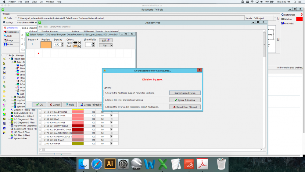
I'm trying to import the USGS lithology .key files and .pat files for a project in Rockworks17. I can import the USGSLithos2.key file, which populates the G-value, Keyword, Fill Percent, Density, and Show in Legend fields, and populates the Pattern field with a colour. I then click on the pattern file of the first entry to bring up a new window, which yields a "division by zero" error (attached screenshot). I am then unable to correctly map the .pat files to get the hatch patterns associated with the .key file. I've tried clearing the Lithology Type Table, mapping the Stratigraphy Type Table, and rebooting the software to no success. Swapping to another project also yields the same error.
Any help would be greatly appreciated.
Thanks,
Joel