

Allison
-
Posts
24 -
Joined
-
Last visited
Everything posted by Allison
-
Is it possible to hang the tops of boreholes by a user defined datum, such as a stratigraphic contact? Thanks!
-
Good Morning: How do you import a cross section shown in Google Earth into a 3-D RW model? Thanks, Allison
-
Thanks!
-
In RW20, is it possible to have the horizontal and vertical scales fitted to any ratio that is on an engineer's ruler (e.g., 1:10, 1:20, 1:30, etc.)? Thanks, Allison
-
Thanks, Molly! I will send the relevant info to support.
-
Won't let me attach borehole data. Says too large
-
Having trouble plotting a surface profile onto a 2D section. Have a .tif file that is the same dimensions as the RW project. Created the RW grid file, which when viewed as a 2D image looks like the original raster. When I try to import the profile onto the section, I get a mostly blank screen with the section squished in the corner. I've attached the .tif as well as an export of the locations from the borehole manager. Thanks, Allison NorthBaseAMs coords.tif
-
What is the website to submit the file? I thought this was the forum to do that.
-
Sorry I haven't responded sooner, Molly. I am currently using RW20 9.3. We use windows meta files to load our cross sections into Adobe illustrator. Raster images are harder to work with in that program. I do view the wmf output file in paint but even when I send it to someone using illustrator, it still looks cut off. I'll send my 2D file to support. Thanks!
-
When I try to export a cross section (Rockplot2D file) to a .emf or.wmf, the cross section gets cut off (see attached). Choosing manual VE of 10 (which is the VE of the section) and a size 11x17 page. This used to work well but now all of a sudden it cuts everything off. Thanks for your help. emf.docx
-
That worked. Thanks!
-
Thanks, Tom! When I try this the grid doesn't clip entirely within the polygon (see attached). I used the null value under Filter type/Exterior and I used the triangle vertices to build the polygon. Is this a gridding algorithm issue or something else? Allison plasticity ternary_w contours.Rw2D
-
Okay, so I thought that RW would contour the data but its contouring the data point density. Is there a means of contouring the chemical data so that the output would look something like the attached? Boron in Tailings Mixture Design 07-16-19.pptx
-
Trying to contour a ternary diagram and contours don't match the Z values posted in the data file. Legend shows weird range of numbers that don't match data file. Granted, I only have four data points. Attached are the data file and the 2D output. The data is related to geotechnical testing (plasticity) of filter cake using percentages of beneficiation, digestion and lime mud Is there anything I can do to get better contours? filter cake_plasticity.rwdat Jadar tailings_plasticity ternary_w contours.Rw2D
-
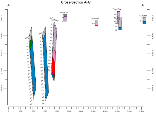
Trying to create a 2-dimensional profile of logs that are not all vertical. Borehole deviations look correct at a 1x vertical exaggeration but then look "smeared" after choosing a higher VE. Can't figure out why it's doing this. Attached a pdf of the 2D section at a VE of 10x. Rockplot - test.pdf
-
I thought that was the case but wanted to make sure I wasn't missing something. Thanks for the quick reply!
-
Can I use a RockWorks17 project in RockWorks16? Do I need to convert the .sqlite to a .mdb or does RockWorks do that for me? Thanks!
-
Exported a 2D striplog as a dxf. When loaded into CAD the following error message appears: "corrupt or incomplete file", and the image can't be opened. Similar 2D striplogs were exported with no problems. When I open the error text message that is saved in my RW project folder, it's blank. Thanks for your help! Allison
-
Is it possible to force RW to use scientific notation? Trying to show values in I-Data as text. Values show up as 0.000151 when I would rather it show up as 1.5E-04. Thanks!
-
I'll give that a try. Thank you!
-
having an issue with the size of the borehole name fonts in the borehole manager. The fonts changed and are now unreadable (see below). Is there a way to modify the font size?

-
How do you show water levels above ground surface. Will the symbols data table in the borehole manager accept positive (above gs) values?
-
Sometimes when I run a multiple log 3-D plot I get the following error messages: "Error in Draw World Grid. Out of Memory" and " Rockplot 3-D registry reference settings may be corrupted". Is this a memory issue or something else? Also not all borelog titles appear in the 3-D view. Is this a problem with spacing? Can it be corrected?