New Versions
RockWorks 16 Update
New build of RockWorks 16 is available
More new features and improvements have been added to RockWorks 16:
+ Customize which menus are displayed in the program - hide those you don't use!
+ New options for display of keywords and comments in 3D striplogs
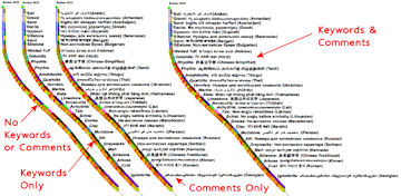
+ Expanded Unicode (non-latin) font support in barchart, piechart, spider, and starburst maps
+ New transparent color and opacity settings for 2D striplog raster images for improved cross section displays

+ The Fill In Missing Stratigraphy, Consolidate, and Pick Stratigraphic contacts programs, and the Consolidate and Pick Lithologic Intervals programs have been moved from their respective menus to the Striplogs menu to be more consistent with Level-3 functionality
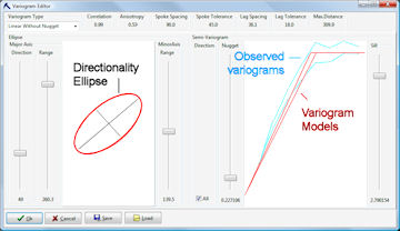
+ New option to pre-grid points for display in the interactive variogram editor (offered when kriging is selected as the gridding method) which improves the variograms for small data sets
+ Improved layer renaming in ReportWorks and RockPlot2D
+ Improved the palette-method of building a custom color table - better color gradations and ascending or descending order
+ much more
Revision list
Read more about RockWorks 16
RockWorks16 feature levels
RockWorks 16 pricing
Download demo
RockWorks 16 EarthApps
Download data for this free program
The EarthApps is the free collection of programs inside RockWorks 16 that outputs maps, displays images, creates flyovers, and provides other functionality in Google Earth. We'll be posting datasets to our website frequently, illustrating the different things you can do with these tools.
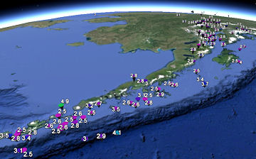
Earthquakes worldwide, magnitude 2.5+, August 2013
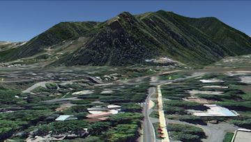
USA Pro Cycling Challenge Stage 1,
Aspen/Snowmass Colorado
Google Earth Flyover
How does this free-program-thing work? The RockWorks 16 demo (link below) works for 2 weeks with all program Levels (1-5) enabled. Full functionality. Everything in the program.
When the trial period expires, the EarthApps (Level 1) are still available for you to use. Just start up RockWorks16 and click the Continue to EarthApps button. If you purchase a license for a higher Level (2-5), we issue a code activating those programs.
Read more
Download data
Download demo
100+ Hatch Pattern Library
Geologic hatch patterns for AutoCAD - New Version
 100 Plus Hatch Pattern Library offers 365 geologic and architectural hatch patterns furnished as separate .PAT files for use with the "Custom" hatch pattern option. 100 Plus Hatch Pattern Library offers 365 geologic and architectural hatch patterns furnished as separate .PAT files for use with the "Custom" hatch pattern option.
100 Plus Hatch Pattern Library Features:
+ Numerous patterns for geologists and architects
+ Compatibility with AutoCAD 2014
+ Includes geologic patterns for use with the Unified Soil Classification System (USCS)
+ Hatch patterns are fully editable and scalable
Read more
100 Plus Hatch Pattern Library pricing
Featured Products
StereoStat
Stereonet and Rose Diagram Software
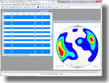 StereoStat is an integrated platform for organizing, manipulating, visualizing and interpreting geological datasets. StereoStat is an integrated platform for organizing, manipulating, visualizing and interpreting geological datasets.
StereoStat offers a flexible and easy-to-user data importer,
comprehensive data manipulation and organization, statistical analysis, and full color plotting. This software is essential for anyone needing high-quality rose diagram and stereonet plotting software.
Read more
StereoStat pricing
Download demo
Grapher 10
Scientific graphing software
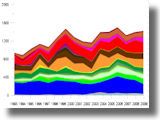 Grapher (TM) is an easy to understand technical graphing program for anyone who needs to create publication-quality graphs quickly and easily. Pick from one of the 30+ graph types, or use the Graph Wizard to create your own. Grapher (TM) is an easy to understand technical graphing program for anyone who needs to create publication-quality graphs quickly and easily. Pick from one of the 30+ graph types, or use the Graph Wizard to create your own.
Grapher lets you customize any portion of any graph to make the graph completely unique to your situation. There are four different types of 2D graphs that can be created in Grapher: linear, bar, polar, and specialty graph types. In addition, many of these graph types are available with a 3D aspect. If you need an extra variable plotted on your graph, try one of the 3D XYZ graphs, the contour maps or surface maps!
Read more
Grapher pricing
Download demo
Web Resources
Videos
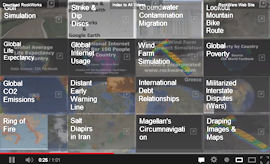
RockWare EarthApps Sampler
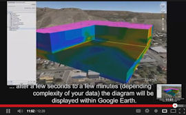
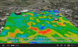
How to Export RockWorks16 Diagrams
to Google Earths - Short Version
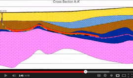
How to Export RockWorks16 Diagrams
to Google Earth - Extended Version
Automatic Computation of Horizontal Wellbore
Paths in RockWorks16
Check out our index to all of our videos - easy to navigate!
RockWare Blog
Visit our blog to read these new postings:
New RockWorks16 EarthApps Video/slideshow
Surreal Underwater River Landscape
Scripting .GRD -> .RwGrd batch conversions
Moon Farside High-Resolution Map Released
Always Keep One Eye Trained Upslope while Driving
How to Export Diagrams from RockWorks16 to Google Earth
"I'm in a place where I'd rather not be surprised." - Luca Parmitano
Examples of Non-Latin Text Output in RockWorks16
More Sinkhole Madness
Strange Log Appears Far Above Other Logs when Hanging Section on Selected Stratigraphic Horizon
New Video: EarthApps Collage-Style Sampler
Columnar Sprites
New Video Using Multi-Seam Coal Data to Demonstrate RockWare Command Language (RCL) Scripting
Low Angle Oblique Impact Lawn Art - by Jonathan Latiano
New Video: Using the RockWare Command Language (RCL) to Automate Cross-Section Generation
Sinkhole Eats Resort
Cool Websites
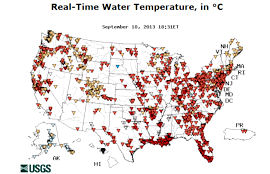
USGS Water Quality Watch
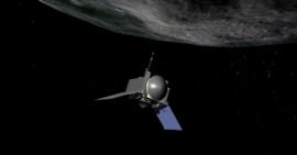
New NASA Mission to Help Us Learn
to Mine Asteroids
Tips
RockWorks 16 - Easy EarthApps Flyovers for Google Earth
You can create a variety of different flyovers in the RockWorks16 EarthApps program. The easiest of all are the "clipboard" flyovers. You just copy a point or path in Google Earth, and RockWorks can quickly make a circular flight around the copied point, or a forward-looking flight along the copied path. Here's how they work:
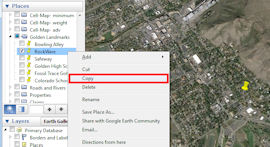
Point-based, circular flyover: Open Google Earth and insert a placemark where you want the center of your flyover to be. Right-click on that point in the Places pane to the left, and choose Copy. Now, go to RockWorks16 and click on the EarthApps program tab. Select the Flyover | Clipboard -> Circular Flyover menu option. Enter the time, altitude, tilt, and radius, click Process, and voila! RockWorks will create a flyover that circles that point.
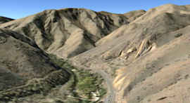
Path-based, forward-looking flyover: Open Google Earth and draw a path where you want the flyover to travel. Right-click on the path in the Places pane to the left, and choose Copy. Go to RockWorks16's EarthApps program tab and click Flyover | Clipboard -> Forward-Looking Flyover. Enter time, altitude, tilt, and smoothing, and click Process. RockWorks will create a flyover along that path.
Read more
RockWorks 16 pricing
Download demo
|



