Featured Software

Additional Software


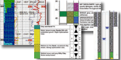
See also: Environmental Software | Geotechnical Software | Mining Software | Petroleum Software
See also: Environmental Software | Geotechnical Software | Mining Software | Petroleum Software
© Copyright RockWare, Inc.